Building reliable demographic baseline for environmental research
Low-geography-level population estimates built from housing and population data.
Population statistics are critical to environmental research and advocacy. For example, measuring the impact of environmental hazards on human health requires knowing not only how many people have lung cancer in an area but also the total population of that area in order to document the incidence of lung cancer, which is often the key quantity of interest.
Population statistics typically come from the U.S. Census Bureau. As our table below highlights, different sources provide population statistics on different time scales and geographies for different purposes. An important gap in these data sources is that annual population data at census block, block group, census tract, place and county subdivision are not available.
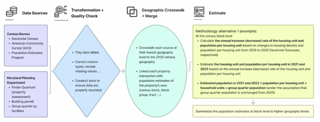
As part of the EIDC, MDI researchers are developing a novel methodology that generates annual population estimates for localized geographies. This will help researchers, community groups and policymakers better pinpoint in the sense of both time and space of the environmental outcomes and potential cause. As illustrated in the diagram below, we started off by applying the data processing and methodology alternative 1 with 2010 and 2020 decennial censuses to estimate the 2021 and 2022 population and subgroups in the state of Maryland for twenty-four counties in Maryland. We are able to know the population in the state and each county, county subdivision, place, tract, block group, and block for 2021 and 2022, respectively, which cannot be found elsewhere.

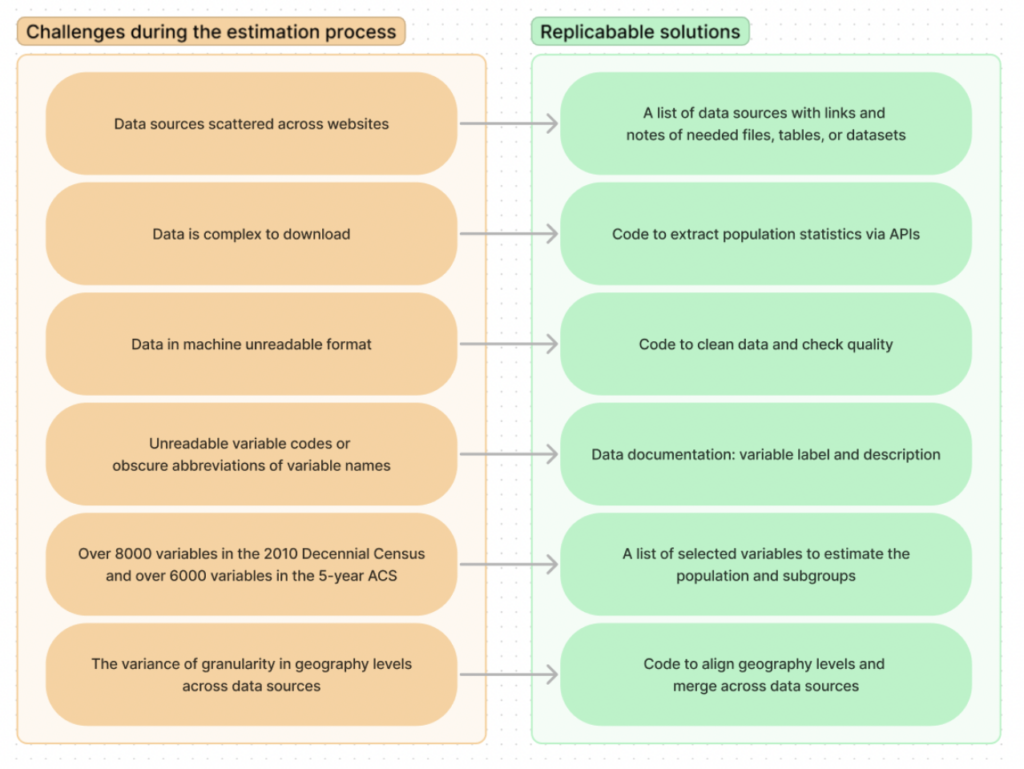
To help others use and develop this methodology in other areas, the EIDC will provide replicable solutions, shareable data sources, code, and documentation. The vision is that conducting studies on population estimates at the lowest geography level on an annual basis will no longer be a daunting task but a new normal.

Written By Xinyu Zheng, summer 2022 MDI Scholar
- Tagged
- EIDC

